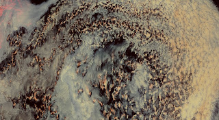
 During ACLOUD we often look at satellite images to determine the coordinated of the flight pattern and have a most recent look on the weather or to analyze in which area and clouds regime the last flights have been finally flown. One instrument we like is MODIS for which a lot of images and products are available online. Looking into the detailled images you can discover a multitude of different cloud structures and phenomena. Especially when using false color images such like these:
Clouds pressing into the fjords...
Vortex like clouds at the southern tip of Svalbard...
Inhomogeneous convective clouds?
Strato cumulus in different scales...


Keine Kommentare:
Kommentar veröffentlichen
Hinweis: Nur ein Mitglied dieses Blogs kann Kommentare posten.